Transitions Newsletter Header

Issue 29 | Spring 2022

Lead Story

The Local Land-Atmosphere Coupling (LoCo) Project

Building Tools and Knowledge to Facilitate R2O and Improved Weather and Climate Prediction
Contributed by Joe Santanello (NASA) and Michael Ek (NCAR RAL and DTC)


Over the last two decades, the hydrometeorological community has made significant progress identifying, understanding, and quantifying the land-atmosphere (L-A) interactions that influence Earth’s water and energy cycles. Under the Global Energy and Water Exchanges (GEWEX; https://www.gewex.org) project, scientists from around the world have been studying coupled model development and improved observations of the global water and energy cycles to improve prediction of weather and climate. The GEWEX structure is composed of four focused, small-group panels of scientists. The four areas of study tasked to understand Earth’s water cycle and energy fluxes, at and below the surface and in the atmosphere, are global datasets (GDAP), atmospheric processes and models (GASS), hydroclimate applications (GHP), and land models and L-A interactions (GLASS). The GLASS LoCo working group is focused specifically on local L-A coupling (LoCo; Santanello et al. 2018), and has developed and applied coupled metrics to Earth system model development.

The LoCo project set out to develop integrative, process-level metrics to quantify complex L-A interactions and feedback that can be applied to models and observations. Specifically, the “LoCo process chain” (see figure 1) describes the water and energy-cycle pathways that connect soil moisture to clouds and precipitation via surface heat and moisture fluxes, and the evolution of the planetary boundary layer (PBL). Over the last 15 years, quantitative metrics have been developed by the LoCo working group that address specific links in this process chain. This led to the development of LoCo community resources such as Coupling Metrics “Cheat Sheets” and the Coupling Metrics Toolkit (CoMeT) to encourage the model-development communities to use these metrics.

Figure 1. Schematic of the LoCo process chain describing the components of L-A interactions linking soil moisture to precipitation and ambient weather (T2m, Q2m), where SM represents soil moisture; EFsm is the evaporative fraction sensitivity to soil moisture; PBL is the PBL characteristics (including PBL height); ENT is the entrainment flux at the top of the PBL; T2m and Q2m are the 2-m temp and humidity, respectively; and P is precipitation. Citation: AMS 99, 6; 10.1175/BAMS-D-17-0001.1

A key feature of LoCo metrics is that they address multiple components of the coupled system as opposed to traditional “one at a time” approaches to model evaluation (see figure 2). Offline, or uncoupled model development (as was typically performed in the past for land-surface models) is suboptimal because it ignores the interaction and feedback with other components of the system (i.e., the atmosphere). Although LoCo metrics are more complex and require multiple observation inputs, which are sometimes difficult to obtain (e.g. PBL profiles), the payoff of their application is significant for a clearer understanding of the coupled processes in the models, and quantitatively assessing how new model physics, datasets, and development cycles impact those processes, including their positive and negative feedbacks. As a result, LoCo metrics are an ideal, though still underutilized, resource for the research-to-operations community because they can serve a beneficial role in facilitating the transfer of scientific knowledge and understanding to model development and, ultimately, operations.


Figure 2. LoCo metrics across temporal scales (x axis), relationship to the LoCo process chain along the y axis, and statistical vs process-based nature (elliptical outlines). Green background shading indicates land surface related states and fluxes, while blue indicates PBL and atmospheric variables. Citation: Bulletin of the American Meteorological Society 99, 6; 10.1175/BAMS-D-17-0001.1

To expand the reach of LoCo, the GEWEX community is participating in projects and outreach efforts across weather and climate modeling centers. These efforts include serving a major role in a NOAA Climate Process Team (CPT) project called CLASP (Coupling of Land and Atmospheric Subgrid Parameterizations) that convenes five climate modeling centers (NOAA, NCAR, NASA, DOE, and GFDL) and focuses on improving the L-A communication of heterogeneity in their respective global climate modeling (GCM) systems. LoCo has also been considered by the numerical weather prediction (NWP) community including NCEP, and is collaborating with DTC to incorporate LoCo metrics into their evaluation and Hierarchical System Development activities (via METplus). Although adoption has been slow, partly due to operational constraints at some of these centers, it is widely recognized that integrated and process-level metrics are an essential tool for the future improvement of Earth system models.


Director's Corner

The NOAA Testbeds and Proving Grounds: A coordinated effort to transition research to operations, services and applications

Andrea Ray and J.J. Brost
Contributed by Andrea Ray, Chair of the TBPGCC, is with NOAA Physical Sciences Laboratory, Boulder, CO, and is a coordinator of the Hydrometeorology Testbed and by John J. Brost, Vice-Chair of the TBPGCC, is also the Director, Operations Proving Ground, Kansas City, MO.

The Test Bed and Proving Ground Coordination Committee (TBPGCC, www.testbeds.noaa.gov) is composed of representatives from the 12 NOAA Testbeds (TBs) and Proving Grounds (PGs), including a member from the DTC.

There are 12 NOAA Testbeds and Proving Grounds. Collectively and individually, they facilitate the orderly transition of research capabilities to operational implementation, and thus, are crucial mechanisms for transitioning research into operations at NOAA and other partners, and ultimately into societal benefits.

Collectively and individually, they facilitate the orderly transition of research capabilities to operational implementation and other applications, often called R2X, and thus, are crucial for transitioning research into operations at NOAA and other partners, and ultimately into societal benefits. The TBPGCC strives to build collaborations and synergies among TBs, and PGs where appropriate, to ameliorate the realities of organizational and funding stovepipes, and take advantage of common opportunities. The TBPG holds an annual workshop and monthly meetings to carry out these endeavors. Just as DTC is a distributed facility where the NWP community can test and evaluate new models and techniques for use in research and operations, TBPGs are working relationships for developmental testing, in a quasi-operational framework among researchers and operational scientists/experts (measurement specialists, forecasters, IT specialists, etc.). Typically, this includes partners in academia, the private sector, and government agencies, whose activities aim to improve or enhance operations in the context of user needs. TBPG activities are two-way interactions with both R2O and O2R, and are iterative whereby any particular project is generally tested multiple ways, and often more than one TBPG involved. Metrics for evaluation and acceptance for operational use vary among testbeds and proving grounds, but generally include evaluation of the research product. First, the tool, method, or analysis is evaluated for how it impacts the resulting skill or quality of resulting products or services. Second is an evaluation of whether it is efficient and effective both in terms of the forecasters’ process to create products, and use by customers. Third, it is evaluated for compatibility with operational hardware, software, data, and communication. 

Picture of the Operations Proving Ground (OPG) Lab, Kansas City, MO.


The network has been engaging in new ways to collaborate over the past several years. Beginning in 2019, the annual meeting changed format from primarily science sharing talks from each TBPG to focusing more on project updates, to a format with sessions framed as learning exchanges about successes, challenges and lessons learned. Sessions also focused on the role and challenges of testbeds for external efforts such as the Unified Forecast System (UFS), artificial intelligence (AI), and cloud computing. This format change improved our collaborative efforts and fostered more open and honest discussion between TBPGs. The 2021 meeting also included the first ever session on social and behavioral sciences, as well as a session about working in the virtual environment. Several testbeds have included some virtual aspects in the past, but the pandemic forced all experiments to go completely virtual. While the virtual environment has had benefits, such as allowing people to participate who might not be able to travel or to leave their positions for a week, it has also had challenges. Inherently face-to-face interactions, including experiments - especially ones that involved using and sharing equipment and facilities - have been seriously hampered. The meeting included sessions focusing on coordination of other TBPGs with the Operations PG, the Satellite PG, and the emerging Fire Weather TB, and on funding issues as well. The push of research funding currently exceeds the capacity of TB/PGs to evaluate efforts. Furthermore, while TBPGs are excited about the advent of UFS and opportunities to use Cloud and AI, generally flat funding limits the potential to take advantage of these for R2X, especially during the transition period from the current NCEP production suite to the Unified Forecast System (UFS). 


NOAA Test Beds and Proving Grounds


The TBPGCC plans to expand efforts to coordinate planning in the upcoming year, and look for collaboration opportunities in the next two to three years, and will expand its efforts to speak as a group on topics such as UFS development. 

Andrea Ray and J.J. Brost


Who's Who

Randy Pierce

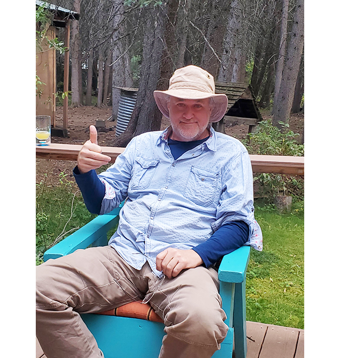
Randy Pierce is a NOAA partner whose software engineering talent supports METexpress. His software engineering role was inspired by his love of detail, building things, and an early curiosity about engineering.

From the beginning, he always had a passion for understanding how things work. He earned a dual bachelor's degree in physics and electrical engineering technology from Colorado State University Pueblo in the Colorado town where he was raised. After graduation, Randy was hired by Storage Technology Corp in Louisville, CO where he settled and made his home, married, and raised two kids. He spent a dozen years there as a hardware engineer developing advanced hardware and software used for automated testing of state-of-the-art enterprise level storage systems. He then pivoted to software engineering, but to make that leap replete, Randy returned to school, at night, to earn a Computer Science degree from Chapman University. After working in a software role for another 14 years with the same company, he and a couple of engineering friends were inspired to create and launch a virtual storage product of their own. In fact, they succeeded in developing the product, but selling it was a greater challenge, as is often the case. After that experience, and a couple of other short-term projects in the area, Randy landed a position with NOAA’s Global Systems Laboratory (GSL) in Boulder decoding weather data from BUFR format. Somehow, the role and responsibilities grew, and he found himself increasingly involved with lab software. Randy became instrumental in the development of the Model Analysis Tool Suite (MATS) framework for the lab and of a newer data ingest paradigm that can store lab verification data in a noSQL document database. MATS, as well as MET, historically used MYSQL relational databases for capturing and organizing meteorological data for statistical evaluation.

In Randy’s words, “I think about software, and data almost all the working day - and sometimes at night. Not because I worry about it, but because I love to build things and I can build things with data and software without having to lift heavy objects or get very dirty! Algorithms and patterns can be fascinating.” He always knew he wanted to be an engineer, and originally, he considered becoming an electrical engineer, but as it is with most lives, interests change and opportunities present themselves, so he shifted his focus to software engineering.

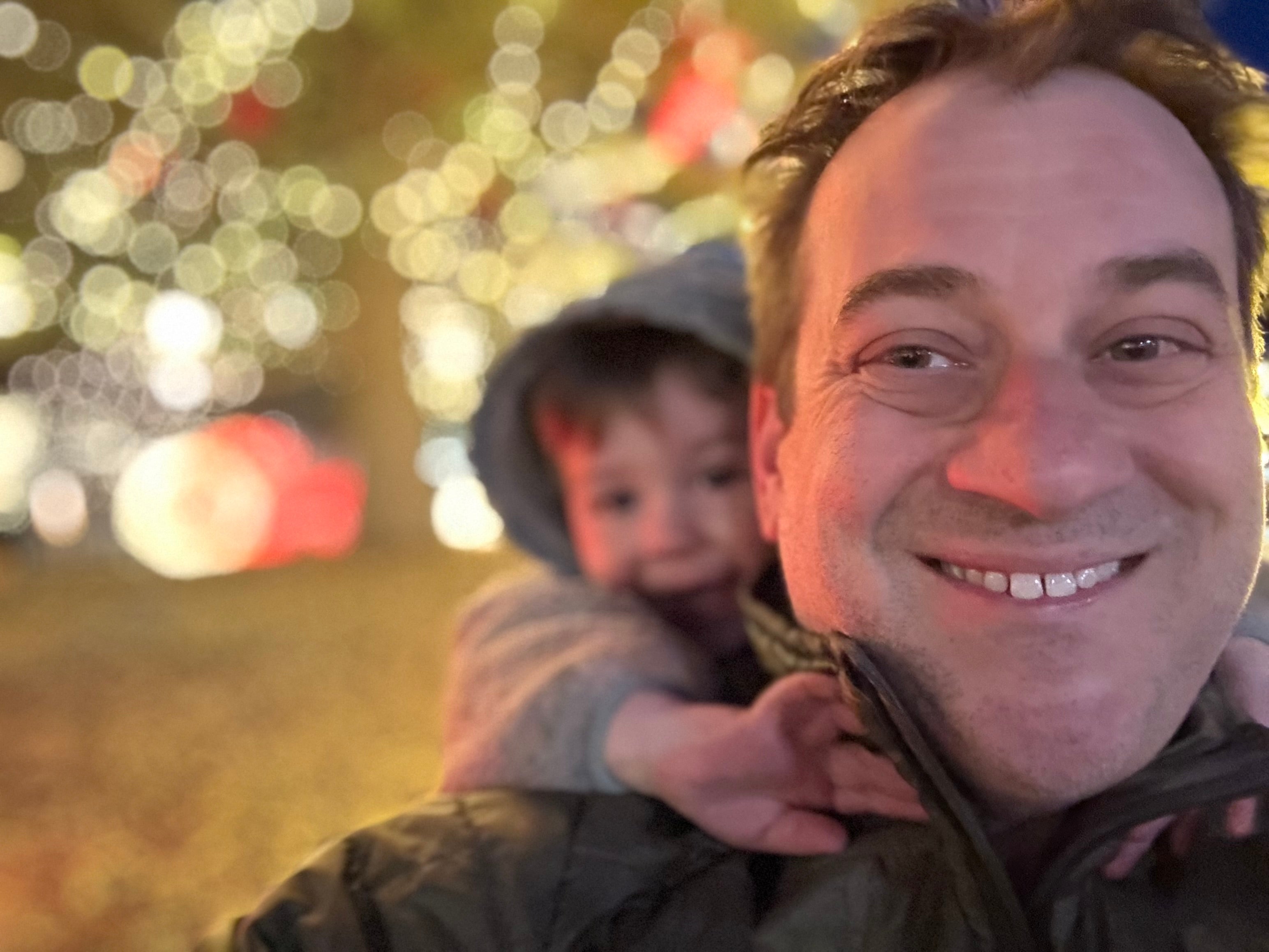
When he isn’t solving coding issues, he can be found enjoying the outdoors or building something in his large shop. He loves working with wood, metal, or whatever material presents inspiration. Unafraid of a challenge, he’s currently tackling the rewiring and re-plumbing of a mountain cabin. He’s an avid (and social) canoeing enthusiast who explores rivers with friends, Word to the wise, he is an accomplished pool player and plays in a league or two, so be forewarned before you challenge him to a friendly game. Hiking, backpacking, fishing, hunting, and anything else that involves the outdoors is where he replenishes.

Vis-a-vis “replenishing,” Randy dreams of developing the perfect battery as a bucket-list item. When asked about this esoteric dream, he replies, “I believe that we as a society need to convert to electric transportation and renewable energy as quickly as we can. Improving batteries is a part of this. I also believe that electric cars are by far more reliable and less expensive than gas powered cars when considered over the long run. I have owned an electric car since 2017 but I want a Rivean R1S SUV because it is, in my opinion, the best electric SUV available (well, available next year). That car can take myself and five companions to any paddling trip I can imagine.”

Randy’s advice? “Waste no days.” It seems evident that he uses all of his days to the fullest.

Randy Pierce


Bridges to Operations

Physics Assessments in Support of the Upcoming GFS and GEFS 2024 Implementations

Contributed by Ligia Bernardet (NOAA GSL and DTC) and Weiwei Li (NCAR RAL and DTC)

The next operational implementations of the Global Forecast System (GFS) and Global Ensemble Forecast System (GEFS) are not scheduled until 2024, but work is underway to code and test a number of upgrades to these modeling systems. While innovations are planned in all aspects of the end-to-end system, the DTC has been particularly involved in supporting the development and improvement of the physics suite as a member of the Unified Forecast System (UFS) Research-to-Operations (R2O) physics subproject.

The GFS and GEFS are configurations of the UFS used for operational numerical prediction. Their 2024 operational implementations will use the Common Community Physics Package (CCPP) for the first time. To prepare for this, a CCPP-based configuration of the GFS using the current operational physics suite was created to serve as a baseline for future development. DTC conducted a thorough assessment of this baseline using process-oriented methods to highlight physical relationships responsible for forecast biases. For example, examination of the relationship between precipitable water and precipitation suggested there is still room for improvement in triggering of deep convection over the central and eastern contiguous United States (CONUS). Additionally, a case study was used for the in-depth examination of a known low bias in convective available potential energy (CAPE) over the CONUS, which suggested a problem with the representation of soil moisture, resulting in reduced evaporation and excessively dry planetary boundary layer (PBL; figure below).

Time-height plot of observed (left) and simulated (right) potential temperature (K, contours) and water vapor mixing ratio (g kg-1, shaded). The thick black lines denote the PBL height. Figure courtesy of Xia Sun (CIRES at NOAA/GSL and DTC).

On top of this baseline, physical parameterizations were added to or improved in the CCPP, and then assessed individually and incrementally to determine their suitability for the upcoming implementation. The DTC staff supported physics developers in adding their innovations to CCPP, conducting experiments in one- and three-dimensional configurations, and analyzing results from their own runs as well as from runs conducted by developers and the NOAA Environmental Modeling Center (EMC).

DTC contributed to a number of evaluations of alternate gravity wave drag (GWD) parameterization configurations, including the assessment of the small-scale orographic GWD implemented in the CCPP by Michael Toy of NOAA Global Systems Laboratory (GSL). For example, DTC contributed kinetic-energy spectra evaluations of a C384 (approximately 25-km grid spacing) run conducted by EMC and C768 (approximately 13-km grid spacing) runs conducted by GSL that ascertained the new configuration did not adversely affect the canonical distribution of energy among various scales of motion. DTC also evaluated innovations in the surface layer, PBL and convective representations, and stochastic physics provided by Jongil Han of EMC and Lisa Bengtsson of NOAA Physical Sciences Laboratory. These evaluations, which on more than one occasion revealed bugs that were subsequently fixed by developers, contributed to the decision to adopt the innovations for the latest GFS/GEFS prototype, dubbed P8.

DTC testing and evaluation also identified innovations that are not yet ready for transition to operations. In particular, evaluations of multiple versions of the Rapid Radiative Transfer Model for Global Climate Models (RRTMG-Parallel; RRTMGP) radiation scheme revealed that this new radiative scheme, or its coupling with other physical processes, produces excessively warm temperatures over Antarctica. The DTC conducted an in-depth investigation using the CCPP Single-Column Model to simulate the Department of Energy Atmospheric Radiation Measurement West Antarctic Radiation Experiment case. Results suggest that the problem seen in the three-dimensional tests may stem from interactions between RRTMGP and the land-surface model and that RRTMGP is more responsive to low-level clouds than the currently operational RRTMG scheme, indicating a need for further investigation.

The integration of DTC testing and evaluation activities with development activities under the auspices of the UFS and UFS-R2O physics working groups represents a new and successful paradigm in cooperation. DTC assessed innovations at a rapid pace and in close collaboration with developers, providing actionable information to assist EMC and project leads in determining physics configurations for the upcoming GFS and GEFS implementation.


Visitors

From Innovations to Operations, the DTC Visitor Program Stimulates Progress

Visitor Program: An Overview
Contributed by Eric Gilelland (NCAR RAL and DTC)

Since 2004, one of the hallmarks of the Developmental Testbed Center (DTC) has been its visitor program. The DTC Visitor Program provides an opportunity for DTC staff and our operational partners to strengthen ties with the research community, which is critical to the success of the DTC’s mission. It began informally when four scientists were invited to work with us for one month over the summer on a project of their choice. The only stipulation was that it had to be consistent with the DTC’s mission. The success of that initial group of visits led to a formal program that started with one-month visits whereby those who wanted to visit submitted proposals in response to the Announcement of Opportunity (AO). Eventually, the program expanded to allow for the two-month visits offered today and the ability to submit proposals year-round. Longer visits for graduate students were also added with the aim of advancing the students’ knowledge about DTC-related work, leading to the two types of projects now supported by the program. Historically, the majority of visitors have come from universities, but visitors from research centers and private companies have also been a strong part of the program (see pie chart figures). The program has also provided the DTC with an avenue to connect with the international community. 

The DTC has hosted a wide array of visitors including both projects conducted by the principal investigator (PI) and projects undertaken by a graduate student under a PI’s direction. Recent PI-led projects include a physics-based evaluation of the Hurricane Analysis and Forecast System (HAFS); an investigation of sub-grid variability and vertical overlap of partial cloudiness within the calculation of atmospheric radiative transfer, work to facilitate the transition of cutting-edge data assimilation techniques into operational NWP modeling; and the implementation of spatial dissimilarity measures into the enhanced Model Evaluation Tools (METplus) verification system.

Ivette Hernandez-Banos was a recent international student visitor who made her way to the DTC just weeks before we transitioned to working from home due to the COVID pandemic, and managed to work through the lockdown. Her success led to an additional DTC project and ultimately she took a job at NCAR in the Mesoscale and Microscale Meteorology Laboratory. Her visit formed part of her doctoral research at Centro de Previsão de Tempo e Estudos Climáticos (CPTEC)/ Instituto Nacional De Pesquisas Espaciais (INPE, Brazil) and she had many fruitful interactions with people from the DTC including Louisa Nance, Ming Hu, Guoqing Ge, Will Mayfield, and Eric Gilleland, in addition to Jacob Carley and Daryl Kleist from EMC.


A look at the Visitor Projects since 2010: The total number of awarded Visitor Projects (not individual participants) on the left. Of the 41 University Visitor Projects, 14 of these were for graduate students on the right. The DTC started supporting PI and graduate student projects and providing 2 months of support for visitor projects in 2010, reflected in these numbers.


Close collaboration with NOAA research and operational centers is essential for effective research-to-operation (R2O) transitions. Dr. Xuguang Wang visited EMC during her sabbatical in Fall 2018. She collaborated with EMC scientists on data-assimilation research and development. The visit expedited the transition of the capability for directly assimilating ground-based radar observation, developed by her Multiscale data Assimilation and Predictability research team, into the operational High-Resolution Rapid Refresh (HRRR) and ultimately the Hurricane Weather Research Forecast (HWRF) system.

Mike Iacono and John Henderson, who visited the DTC from industry on multiple occasions, have found their interactions with the DTC to be a rewarding opportunity as it afforded them new insights on this research topic, and successfully transitioned physics enhancements to NOAA operations. The new exponential random cloud overlap method they developed in their most recent DTC visitor project was transitioned into the 2020 operational HWRF, after testing and evaluation performed by DTC showed that it resulted in improved tropical cyclone track forecasts. This team of Iacono/Henderson split their visit into multiple shorter visits and even split them between the 2 PIs.

Obviously, the COVID pandemic made it difficult to host in-person visits, but we nevertheless were able to host visitors virtually. As the pandemic begins to wind down, we have been able to once again host visitors on-site. For example, Chong-Chi Tong and Bill Gallus were both able to join us in person last Fall as the capability for staff to work in the building again has gradually increased. Bill Gallus also has conducted multiple projects with the DTC Visitor Program, as have other individuals and teams. 

It has been a very exciting and successful program that has brought many advances from research into operational use over the years, even during the pandemic. Now that our buildings and cities are starting to open back up, we’ve had an uptick in visitor applications, with two recently approved. 

Past visitors have expressed appreciation, gratitude and value about their visitor project experiences. One visitor, Don Morton, proclaimed his visits to be the high points of his 30+ year career. The visitor projects are also high points for the lucky DTC staff who gain valuable knowledge and insights from these visitors. Past Visitor highlights that include project details and personal perspectives about the project can be read at DTC Newsletter | Visitors Articles. For a deeper dive, read the DTC Visitor Reports.


Community Connections

The GeneralIzed Aerosol/chemistry iNTerface (GIANT)

Workshop and Hackathon
Contributed by Ligia Bernardet (NOAA GSL and DTC), Natalie Mahowald (Cornell University), and Alma Hodzic (NCAR ACOM)

An Earth System Model (ESM) is a model that represents various domains of the earth, such as atmosphere, ocean, sea ice, etc. A new community effort is underway to devise a method to transfer information easily and consistently between chemistry and aerosol modules, and other components of ESMs. Currently, it is difficult to study and quantify feedbacks of chemistry/aerosol parameterizations on weather and climate because of the structurally diverse ways in which chemistry/aerosols modules are integrated in ESMs. This complexity interferes with testing the aerosol/chemistry independently from the meteorology. Furthermore, the plethora of different structures used in the ESMs to connect the aerosol/chemistry modules makes it impossible to swap the modules between ESMs, making it difficult to isolate the uncertainties from the aerosol/chemistry module versus the atmospheric model. Improving the interoperability of aerosol/chemistry modules opens the door to addressing important uncertainties in ESM predictions, such as aerosol-cloud interactions, direct aerosol radiative effects, and climate impacts on air quality.

To find avenues for increased interoperability and collaborative research, the virtual Generalized Aerosol/Chemistry Interface Workshop was held on February 16, 2022. The organizing committee was international and multi-institutional: Natalie Mahowald (Cornell University), Alma Hodzic (NCAR), Ligia Bernardet (NOAA Global Systems Laboratory and DTC), Pete Bosler (Sandia National Laboratory), Tom Clune (NASA), Matt Dawson (NCAR), Barron Henderson (Environmental Protection Agency - EPA), Jeff Johnson (Cohere Consulting, LLC), Xiaohong Liu (Texas A&M University), Po-Lun Ma (Pacific Northwest National Laboratory, Naval Research Laboratory), Benjamin Murphy (EPA), Nicole Reimer (University of Illinois), and Michael Schulz (Meteorologisk institutt Norway).

The 76 workshop participants represented NOAA, many US National Laboratories (NCAR, Joint Center for Satellite Data Assimilation, NASA, Jet Propulsion Laboratory, DOE Pacific Northwest National Laboratory, Sandia National Laboratory), US Universities (California Irvine, Columbia, Cornell, Miami, Michigan, Texas A&M, New York SUNY), and international institutions (Brazil, China, Finland, France, Germany, Poland, and the United Kingdom), see chart for distribution. During the three-hour event, participants worked in breakout groups to discuss the complexities and requirements of specific aerosol/chemistry-related processes, such as the interactions of aerosols with radiation and microphysics, data assimilation, emissions, removal, diagnostics, and many more.

Affiliation of the Feb 2022 workshop participants.

As a follow up to the workshop, several virtual hackathons were held. A hackathon is a design sprint-format event, in which software engineers and scientists involved in software development collaborate intensively on software projects. This event was conducted to examine the practical aspects of building an interface that can be used across multiple ESMs.

Two hackathon events took place on April 29 and May 6, 2022. During the week between the two events, the hackathon participants worked on the problem individually (as opposed to synchronously, when they all came together virtually as a group). The first hackathon in the series, was focused on building an interface for computing aerosol optical properties and their feedbacks on radiation, a relatively straightforward, but key process for estimating aerosol impacts on weather and climate. Hackathon organizers supplied a single-dimensional (box) host model, dubbed a driver, which was used and modified by the participants to call their aerosol optics code and force it with prescribed aerosol descriptions (properties such as composition and size). This first step was to identify the required elements of an aerosol interface definition. Future work will incorporate chemical, microphysical, land, ocean, and other processes. The intention is that participants will represent various modeling centers and community ESMs, and will work on the interoperability of their aerosol optics code with a generic host model. A third hackathon event is planned for May 20.

The intended goal of this hackathon, along with additional activities planned for the upcoming months, was to further inspire the community to develop a new interface (tentatively called GeneralIzed Aerosol/chemistry iNTerface - GIANT), which will support forward-looking studies involving the interaction of aerosols/chemistry with weather/climate, and facilitate the exchange of chemistry/aerosols models used in ESMs.


Did you know?

New US Council for Interagency Coordination of Meteorological Service

In April 2017, the President signed into law the Weather Research and Forecasting Innovation Act. This Act required establishing an Interagency Committee for Advancing Weather Services -- The Interagency Council for Advancing Meteorological Services (ICAMS) meets this requirement. ICAMS serves to improve coordination of relevant weather research and forecast innovation activities across the United States Government. Sixteen various Departments and Agencies comprise ICAMS, including NSF, NOAA under the DOC and NASA.

Better coordination among federal agencies and expanded partnerships with the weather enterprise will foster improved weather, water, and climate information for the American public, ensuring US leadership in the world in meteorological services via an Earth-system approach, providing information that directly benefits society. ICAMS, chartered July 2020, was championed by US government administrative leaders, at that time, Dr. Kelvin Droegemeier and Dr. Neil Jacobs. Note that ICAMS replaces the former Office of the Federal Coordinator for Meteorology and the former National Earth System Prediction Capability with a section on the ICAMS resource webpage that bridges the past and present.

The work of the ICAMS is organized under four primary committees: 

  • Committee on Observational Systems – Coordinates all relevant land/air/ocean/space-based observation systems and associated data capabilities for meteorological research and services.
  • Committee on Cyber, Facilities, and Infrastructure – Coordinates all relevant computing, data, networking, and security elements for operations and research.
  • Committee on Services – Coordinates meteorological services encompassing weather, climate, hydrological, ocean, and related environmental services. Services include all relevant activities that provide value to society whether over land, at sea or in the air.
  • Committee on Research and Innovation – Coordinates an Earth system approach to advance meteorological services including definition of research topics, community engagement, coordination among research organizations, engagement of multi-sector enterprise to maximize technological innovation, creation of new modalities/processes/efficiencies, building collaborations, and pursuing frontier capabilities.