One of the regional numerical weather prediction models used operationally by the National Weather Service is the Hurricane WRF (HWRF), a coupled model with atmospheric and ocean components that exchange fluxes of short- and long-wave radiation, momentum, moisture, and heat. The momentum flux is particularly important because the strong winds in tropical cyclones cause turbulence and upwelling in the ocean, which can lead to transport of cold water from deep in the ocean towards the surface, reducing the storm’s energy source and causing it to weaken.
Comparison
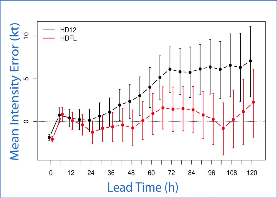
A comparison between the ocean cooling in HWRF against observational buoy data, performed by the Hurricane Research Division of NOAA’s Atlantic Oceanographic and Meteorological Laboratory, showed that the ocean surface cooling in HWRF is too small. The DTC worked with the NOAA Environmental Modeling Center and oceanographers from the University of Rhode Island to formulate a test in which the momentum flux in the ocean model was altered to be more physically consistent. The figure below shows the mean intensity error as a function of lead time for 2012. The black curve is the control and the red curve is the forecast with modified fluxes with 95% confidence intervals.
Results
Results aggregated over all 2012 Atlantic storms showed the more physical flux reduced the 5-kt positive intensity bias of the operational model to near-zero. This change has been incorporated by EMC into the 2013 HWRF baseline, and is expected to be adopted operationally for the 2013 hurricane season.