Over the sixteen years the Method for Object-Based Diagnostic Evaluation (MODE) tool has been available within the Model Evaluation Tools (MET), operational forecasting centers have explored its utility for informing the model development process and evaluating operational products in meaningful ways. Through this exploration, MODE has provided insightful information for operational implementation decisions and meaningful data about the performance of operational products.
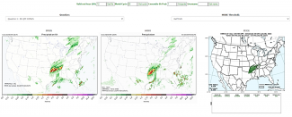
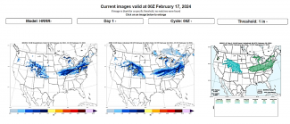
MODE has been applied to many different phenomena; here we describe applications at NCEP’s Weather Prediction Center (WPC). Building on the relationship between DTC and WPC, established through collaborations related to NOAA’s Hydrometeorology Testbed (HMT), WPC and DTC staff worked closely together to incorporate advanced verification techniques available in the enhanced Model Evaluation Tools (METplus) into their verification workflow. Through this deep collaboration, WPC began publicly displaying real-time verification using MODE in the early 2010s. The initial application to quantitative precipitation forecasts (QPF) has matured over the years to include snowfall and more advanced diagnostics. WPC provides publically available real-time displays of its object-based QPF and snowfall verification, and MODE continues to be a key tool for WPC’s HMT Flash Flood and Intense Rainfall Experiment (FFaIR) and Winter Weather Experiment (WWE). After the capability to track objects through time was added, WPC used the MODE Time Domain tool to construct a number of products that are used for real-time model analysis to communicate the uncertainty in the predictions. Focusing on heavy precipitation events, these tools analyze objects on both hourly and sub-hourly timescales to evaluate the positioning, size, and magnitude of snowband objects in real time. WPC also uses MODE internally for unique verification. These applications include determining displacement distance of predictions by the WPC, National Blended Model (NBM), and Hurricane Analysis and Forecast System (HAFS) QPF for landfalling tropical cyclones (Albright and Nelson 2024), and verification of the Mesoscale Precipitation Discussion and Excessive Rainfall Outlook, among other applications currently under development. WPC is also introducing the next generation of scientists to useful applications of MODE through hosting Lapenta interns (Christina Comer, Austin Jerke, and Victoria Scheidt between 2020-2022).
From the FFaIR verification page:
From the WWE 2024 MODE page:
When run on different computing platforms, complex numerical weather prediction systems will not necessarily produce forecasts that match bit-for-bit due to differences in precision. Nonlinearity and parameterizations with threshold behaviors (e.g., convective parameterizations) tend to cause these differences to widen with forecast lead time, making it difficult to validate the implementation of an operational forecast system on a new computing platform. While assisting the United States Air Force (USAF) with an implementation validation test, DTC staff developed a novel approach for applying MODE to this type of validation exercise. MODE was used to identify coherent objects that exceeded a threshold for differences between a baseline and new implementation. The properties of these objects were then analyzed to provide insight into potential sources for the associated differences.
The impacts of MODE on operational decisions extends beyond the US. The UK Met Office used MODE to assess the position, timing, and intensity of jet cores, surface highs and lows, and changes in the behavior of these forecast synoptic features as part of their pre-implementation assessment of a new dynamical core. This assessment found the combination of a new dynamic core and increased resolution produced a more energetic and active atmospheric model with deeper lows and stronger highs and jet cores (Mittermaier et al 2016). In addition, the Bureau of Meteorology has found MODE useful for evaluating the quality of their Heatwave forecast maps, in particular for severe and extreme areas. This work revealed an over-forecast bias in terms of both spatial spread and intensity (personal communication, Nickolas Loveday).

MODE Forecast objects with analysis outlines for a single NN768EG forecast (t + 48 hr) valid at 0000 UTC 9 Dec 2012. Colors indicate distinct objects. (a) Low pressures less than 990 hPa, (b) high pressure greater than 1036 hPa, and (c) 250-hPa jet cores stronger than 60 m s−1 (from Mittermaier et al. 2016)

