This winter of 2015-2016, the DTC had the pleasure of hosting visiting scientist Dr. Liantang Deng of the Numerical Weather Prediction Center, China Meteorological Administration (CMA). His visit stemmed from the combined Weather Research and Forecasting (WRF) and Global/Regional Assimilation and PrEdiction System (GRAPES) modeling workshop in 2014, when Dr. Bill Kuo, Director of the DTC, helped facilitate interactions between the DTC and CMA. During his 2-month stay, he evaluated the GRAPES model by utilizing baseline data sets within the Mesoscale Model Evaluation Testbed (MMET), a framework established by the DTC to assist the research community in efficiently demonstrating the merits of new developments.
Dr. Deng’s testing focused on the historic derecho case of 29 June 2012, which impacted many states in the Mid-western and Mid-Atlantic regions. The GRAPES model domain and forecast period were set up similarly to the MMET baseline 12-km parent domain, which covers the full CONUS region, and is integrated out to 84 hours; the initial and boundary conditions were derived from the GFS at 12 UTC on 28 June 2012. For Dr. Deng’s visit, he focused on the Advanced Research WRF (ARW) baseline, which was initialized with NAM and run with the operational Rapid Refresh (RAP) physics suite.
Post-processing of the GRAPES model output was conducted using the NCEP Unified Post-Processing (UPP) software. Even though UPP does not currently support the GRAPES model, Dr. Deng worked diligently to add and modify routines necessary for proper I/O, including addressing the vertical and horizontal grid-staggering, as well as addressing routines for select post-processed fields. These modifications are a welcome addition to UPP and can potentially be released as a community contribution in a future release. After the post-processing step, the DTC’s Model Evaluation Tools (MET) were used for the verification process and included statistical results for surface and upper-air point observations, as well as gridded precipitation observations.
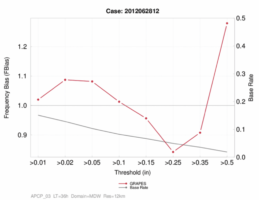
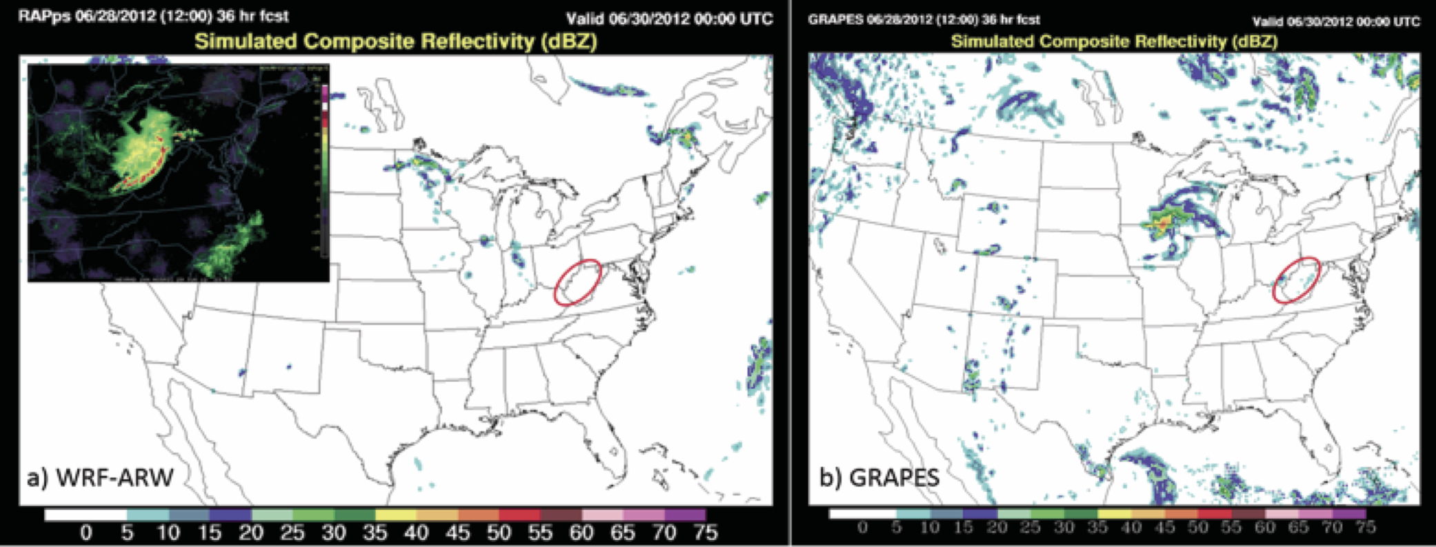
Although the GRAPES model was able to resolve a storm over the Midwest, the timing was behind and the location was too far north (Figure b). The strong leading edge observed in the storm did not form in the model, and it weakened as is moved eastward. This, compared to the ARW baseline failed to capture the event (Figure a), illustrating the impact of the different physics suites and different initial and lateral boundary conditions have on the model forecasts. The ARW initiated a storm, but instead of strengthening as it moved eastward across the Midwest, it actually dissipated. GRAPES formed a storm but was not accurate in timing, location, or forming the strong leading edge. A look at the 3-hour accumulated precipitation frequency bias at the 36 hour lead time over the Midwest (Figure below) shows a small high bias at the lowest thresholds, transitioning to a small low bias at higher thresholds, with exception of the highest threshold. This plot shows that even though the timing and location of the storm were off, GRAPES did a decent job of forecasting the accumulated precip amounts (with a little over prediction of the low thresholds and underprediction of higher thresholds).
Dr. Deng was very grateful to collaborate with the DTC and was surprised at how much he was able to accomplish in his short visit. We here at the DTC enjoyed working with him and would welcome him back for future visits to continue his work.