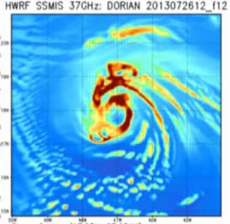
As the 2013 hurricane season continues in the North Atlantic and eastern North Pacific basins, a newly minted HWRF model is providing forecasts for the National Hurricane Center (NHC) on a new machine and with significant code additions. On July 24, the operational HWRF went live on the Weather and Climate Operational Supercomputing System (WCOSS). A research version for testing continues in use on the jet computers at the NOAA ESRL Global Systems Division. New, more efficient code promises to provide quicker processing, allowing timely forecasts and the opportunity to use more sophisticated physics routines.
This year’s HWRF has several new features and options. Among the most significant are:
1. New data assimilation options. The HWRF can now assimilate wind information from the tail Doppler radar (TDR) on hurricane flight aircraft.
2. Use of hybrid data assimilation system, which allows better use of observations to initialize the model.
3. Increased code efficiency, which allows physics packages to run at 30 second intervals as compared to last year’s 90 seconds.
Additionally, this year’s HWRF public release, for the first time, supports idealized tropical cyclone simulations and hurricane forecasts in basins beyond the eastern North Pacific and North Atlantic.
The DTC conducts testing and evaluation of HWRF, and also serves as an accessible repository for HWRF code. Software version control assures that HWRF developers at EMC, GSD, and other operational and research institutions obtain consistent results. Particular attention has been paid to facilitate the inclusion of new research developments into the operational configuration of all HWRF components. For instance, updated model routines for the Princeton Ocean Model for Tropical Cyclones (POM-TC), developed at the University of Rhode Island, can be seamlessly introduced.
Ambitious plans for the HWRF in 2014 and beyond include code allowing multiple moving nests in the same run, additional targets for data assimilation (dropsondes, etc.), and post-landfall forecasts of ocean surge, waves, precipitation, and inundation.
See the HWRF v3.5a public release announcement in this issue.
