The National Weather Service (NWS) Meteorological Development Laboratory (MDL) is developing an automated, nationally consistent and centralized service that verifies Quantitative Precipitation Forecasts (QPF). This QPF Verification Service (QPFVS) will provide objective assessments of the predictive skill of numerical model guidance and official NWS forecasts to help increase the accuracy of quantitative precipitation forecasts. QPFVS will be implemented as a component of a larger gridded verification system with custom front-ends to serve various user communities, such as aviation weather, public weather, and water management/hydrology.
MDL uses the Model Evaluation Tools (MET) software package from the Developmental Testbed Center (DTC) to generate verification results for QPFVS. The MET software has a robust set of verification techniques (station, grid, ensemble, object-oriented) and metrics that meet the NWS requirements for QPFVS and is well supported by extensive documentation and a responsive help desk. The NWS Weather Prediction Center (WPC) and Environmental Modeling Center (EMC) also use MET software, which allows MDL to ensure consistency in techniques and verification scores across the NWS.
QPFVS is accessed via a web-based Graphical User Interface (GUI) and includes datasets from the National Digital Forecast Database (NDFD), National Blend of Models (NBM), High-Resolution Rapid Refresh (HRRR), and Global Forecast System (GFS). To verify, QPFVS uses UnRestricted Mesoscale Analysis (URMA) QPE06 (Quantitative Precipitation Estimation) gridded analysis as the truth. The forecasts and analysis are displayed on a flexible zoom-and-roam interface.
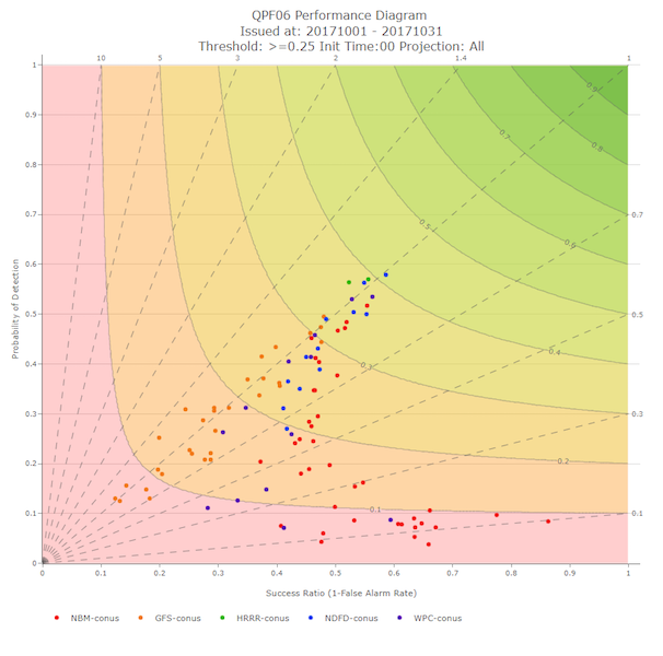
The QPFVS Statistics page can be used to query a database to generate plots and tables of verification scores. The plots are interactive, allowing users to interrogate and save graphics for reports and presentations and download tabular verification data in CSV (Comma Separated Values) format. The current version, QPFVS v1.0 contains gridded verification scores with plans to add station-based verification and more sources in QPFVS v2.0.

QPFVS leverages the MET Docker Container to produce gridded statistics in real-time. To generate gridded verification, QPFVS first uses MET to convert NDFD forecasts and guidance to the common URMA grid definition. The forecasts, guidance, and analysis are then processed through additional MET programs to generate gridded verification statistics at various geographic scales (i.e., national, regional, and local) and are stored in a database. The QPFVS GUI allows users to easily build a custom query of the database with choices such as location(s) of interest, data source(s), and date range.
MET output of forecasts, guidance, and analysis data on the common URMA grid are also converted into Georeferenced Tagged Image File Format (GeoTIFF) images. Additional features include the ability to view time series of QPF data at individual grid points.
The MET software and team have been very helpful in establishing QPFVS v1.0. MDL anticipates MET will continue to be useful in meeting additional QPFVS requirements, including station-based verification, probabilistic verification, and object-oriented verification.
Contributed by Tabitha Huntemann and Dana Strom.