Transitions Newsletter Header

Issue 5 | Summer 2014

Lead Story

Microphysics, from Water Vapor to Precipitation

Contributed by Greg Thompson

NCAR-RAL has a long track record of transitioning numerical weather prediction (NWP) model cloud microphysical schemes from research to operations.

Beginning in the 1990s, a scheme by Reisner et al (1998) was created within MM5 (Fifth-Generation Penn State/NCAR Mesoscale Model) but also transitioned to the Rapid Update Cycle (RUC) model. A few years later, the scheme was modified and updated for both MM5 and RUC by Thompson et al (2004). Then, as the Rapid Refresh (RAP) model was replacing the RUC, an entirely rewritten microphysics scheme by Thompson et al (2008) was created for operational use in the Weather Research and Forecast (WRF) and RAP models. A primary goal of each of these efforts was to improve upon the explicit prediction of supercooled liquid water and aircraft icing while also improving quantitative precipitation forecasts (QPF) and surface sensible weather elements such as precipitation type.

The established pathway for transition to operations for the Thompson et al (2008) microphysics scheme is greatly facilitated through the WRF code repository and a continual collaboration with NOAA’s Earth System Research Laboratory (ESRL) and Global Sciences Division (GSD), especially the team led by Stan Benjamin. Various improvements to the scheme are rapidly implemented into prototype operations at NOAA-GSD for further testing before they eventually transition to the National Centers for Environmental Prediction (NCEP) Environmental Modeling Center (EMC) in the fully operational RAP model at NCEP.

The two-panel figure shows a 48 hour forecast of model lowest level radar reflectivity valid at 0 UTC 02 Feb 2011 made by the WRF-ARW (top panel) model and NEMS NMMB model (bottom panel).

A more recent DTC effort has included the testing and evaluation of the Thompson et al (2008) microphysics scheme into the Hurricane WRF (HWRF) model to see if it improves tropical cyclone track and intensity forecasts. During development, the scheme’s developers had not previously worked in the area of tropical cyclone prediction, but focused instead on mid-latitude weather. The current test may reveal potential improvements to tropical storm prediction or shortcomings in the microphysics scheme that could lead to future improvements.

A second DTC effort is the incorporation of the Thompson et al (2008) microphysics scheme into NCEP’s NEMS-NMMB (NOAA Environmental Modeling System-Nonhydrostatic Multiscale Model on B-grid) model, which is also the current North American Model (NAM). As the NAM transitions to higher and higher resolution, the potential use of alternative microphysics schemes is being considered. To achieve this goal, a number of structural code changes to NEMS-NMMB model were made to accept the larger number of water species used by the Thompson et al (2008) scheme, as compared to number of species in the operational microphysics scheme. However, the extent of code changes directly within the microphysical module was very minimally different than the existing WRF code, which greatly facilitates future WRF-code transitions to NEMS-NMMB.

The two-panel figure above shows a 48 hour forecast of model lowest level radar reflectivity valid at 0000 UTC 02 Feb 2011 made by the WRF-ARW (top panel) model and NEMS-NMMB model (bottom panel). Particularly evident in a comparison of the two model cores are sporadic low-value dBZ forecasts seen in broad areas of the NMMB and to a much lesser degree in the WRF, suggesting a much greater presence of drizzling clouds in the NMMB. Also shown in the figure at the beginning of the article (page 1) is the WRF-predicted explicit precipitation type with blue/pink/green shades representing snow, graupel, and rain, respectively, along with an overlay of colored symbols to represent the surface weather observations of various precipitation types. The notable lack of graupel observations vis-à-vis forecasts likely reflects deficiencies of automated observations.

AMS, Thompson et al. 2008, http://journals.ametsoc.org/doi/abs/10.1175/2008MWR2387.1 and 2014, http://journals.ametsoc.org/doi/abs/10.1175/JAS-D-13-0305.1


Director's Corner

Bob Gall

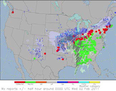
I was part of the Development Testbed Center from its beginnings as part of the WRF (Weather Research and Forecasting) model development, which in turn was part of the US Weather Research Program (USWRP). The years are beginning to blur for me but I believe the first discussions of a DTC in Boulder were during an IWG (Interagency Working Group) meeting of the USWRP at NCAR on October 22, 2002. At that meeting the vision for the DTC was stated as a facility which would:

• Provide for a rapid and direct transfer of new NWP research results into operational forecasting

• Evaluate strengths and weaknesses of new methods and models for NWP prior to consideration for operational implementation

• Evaluate strengths and weaknesses of current operational systems

And later we added:

• Do these in a way that doesn’t interfere with operations

More discussions followed, but the DTC project basically was underway by the next summer. I led the DTC from its inception until I left to be Development Manager of the HFIP (Hurricane Forecast Improvement Program) in 2009. During that time Steve Koch and I gradually built up the project both at NCAR and at GSD/ESRL in Boulder as a joint agency effort. Louisa Nance was its first employee and has been with the program ever since. The program was gradually expanded to what you see today and Bill Kuo took over as Head after I left.

As we began to spin up the HFIP Project in 2009 we realized early that one of its goals needed to be to make the operational NWP hurricane model system widely available. Only in that way could HFIP make effective use of ideas and technology from the community (broadly defined as university, government laboratory and other folks). The mission of EMC is to develop, test and implement the operational system—a full time job for the HWRF group—and they are not equipped to deal extensively with making the codes available to the community.

The DTC, on the other hand, was equipped for this task, and thus early in the HFIP program we began to fund a significant program to make the HWRF available to the community.

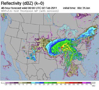
It was our intention to focus the HFIP program on a single model system (like the original idea for the WRF system) as a way to make maximum progress in improving the hurricane forecast guidance system. From the beginning we felt that system needed to be HWRF, principally because that system was being developed at EMC at the time and there was a team there focused on all aspects of the model development (core, physics and the initialization system) and how they all integrated together. The only other similar team in the US was the one running TC-COAMPS for NRL. Such a team was not in place for other hurricane NWP forecast systems in the US, such as the AHW (Advanced Hurricane WRF) being developed at NCAR. Since the central goal of HFIP is to develop the NCEP operational hurricane system into the best in the world, HWRF was the obvious choice. The DTC, which had an extensive knowledge base for making codes available to the community and to handle interactions with the community for HWRF, was also an obvious choice. HFIP has provided significant funding for the last several years to the DTC to set up and make available a code system in Boulder for HWRF, including documentation, and to work with EMC to coordinate that code with the most current operational HWRF codes. In addition we also provided funding for university projects to work with these codes. The end result, for HWRF, is a paradigm that is essentially equivalent to the original vision for both WRF and the DTC given above.


Who's Who

Laurie Carson

When Laurie says “Well, this isn’t exactly rocket science,” we’d be well-advised to listen; she actually was a rocket scientist. After her physics degree at Iowa State, she worked as a scientific programmer at the aerospace divisions of General Dynamics and Martin Marietta on orbital mechanics and other satellite-related projects. The ups and downs of the defense industry eventually began to wear on her, and in 1992 she came to Boulder to work at NCAR, gradually moving into NWP activities. Laurie joined the DTC as a software engineer in 2008, and since then has been a go-to contributor for several projects that involve the NEMS modeling system from EMC, in particular the NMMB dynamic core now in active development. A focus of these efforts has been to port, configure and test a variety of model configurations on different computing platforms. Along the way she has worked with Jamie Wolff on NAM testing on the NCAR Yellowstone computing system, with Isidora Jankov on NARRE (North American Rapid Refresh Ensemble) related testing on NOAA’s Zeus computing system, and with Greg Thompson on microphysics/radiation coupling, also on the Yellowstone system. She has also been working with DTC and EMC staff to develop some basic user guides for the NEMS community. Given these efforts, it’s not surprising that she would judge her most valuable and enjoyable tasks to be those that contribute to community support, and that involve interaction at a working level with EMC and DTC colleagues.

Perhaps the requirements of a detail-demanding job at DTC do carry over, for better or worse, into non-work time; this would help to explain the interest in quilting suggested by the picture!


Community Connections

An HWRF Tutorial in Taiwan

Contributed by Ligia Bernardet, photos by Bill Kuo
Tim Brown-DTC, Qingfu Liu-EMC, Yong Kwon-formerly of EMC, Ligia Bernardet-DTC, Vijay Tallapragada-EMC, and Sam Trahan-EMC some of the HWRF instructors, May 2014, Taipei, Taiwan.

The Hurricane Weather Research and Forecasting model (HWRF) is a U.S. operational hurricane prediction model used by the National Hurricane Center for tropical cyclone track and intensity forecasts in its basins of responsibility: North Atlantic and Eastern North Pacific. However, HWRF can be employed in any basin. In 2013 the HWRF real-time runs conducted by the NOAA Environmental Modeling Center (EMC) for the West Pacific basin were found to be very valuable by the Joint Typhoon Warning Center (JTWC). Because of the demonstrated skill of the HWRF model and its advanced capabilities, there has been a strong interest in HWRF from the research community as well as the international weather centers that are responsible for tropical cyclones forecasting. Currently, there are more than 1000 registered users for HWRF. With a goal of encouraging the participation of international research and operational community in the development and applications of HWRF, the NOAA Hurricane Forecast Improvement Project (HFIP) sponsored an HWRF tutorial in Taipei, Taiwan, 22-23 May 2014. The HWRF Tutorial was held immediately following the Workshop on Numerical Prediction of Tropical Cyclones, 20-21 May 2014, which was attended by about 60 scientists from Taiwan, U.S., China, Japan, S. Korea, India, Vietnam, Thailand, the Philippines, and Malaysia. Fred Toepfer, HFIP Program Director, gave a keynote speech at the workshop. The HWRF Tutorial was organized jointly by DTC, EMC, HFIP, Taiwan’s Central Weather Bureau (CWB), and the Taiwan Typhoon Flood Research Inst (TTFRI). Twenty-six students from Malaysia, the UK, Thailand, Vietnam, USA, Singapore, and Taiwan participated. The tutorial instructors included Robert Gall of HFIP, Vijay Tallapragada, Young Kwon, Sam Trahan, Qingfu Liu, and Chanh Kieu of EMC, and Timothy Brown and Ligia Bernardet of DTC. The feedback from the students was overwhelmingly positive, in spite of the torrential rain of 14 inches in 24 hours which fell in Taipei during the event! We anticipate an increased use of HWRF in the West Pacific typhoon community in the years to come, which will lead to valuable collaboration on the continued development on HWRF.

Students in the classroom
Vijay Tallapragada lecturing


PROUD Awards

HOWARD SOH, Software Engineer III, NSF NCAR RAL & DTC |

Howard Soh is a Software Engineer III with the NSF NCAR Research Applications Laboratory who contributes to the development and support of the Model Evaluation Tools (MET) statistical component of the METplus system at the DTC.

Howard splits his time between the National Security Applications Program (NSAP) and the Joint Numerical Testbed (JNT), but his contributions to METplus far exceed expectations for that allocation. He is a fully engaged and active member of the METplus team and is a leader in several critical aspects of MET: SonarQube static code analysis, Python embedding, NetCDF APIs, point observation data ingest, and adding support for unstructured grids. Howard also monitors the METplus Discussions forum, where users submit questions for help, and provides his expertise when needed. He often answers the questions via email or Slack well before the person monitoring Discussions for that day has even read the question!

The DTC is proud to recognize Howard for consistently demonstrating excellent technical ability, initiative, communication, and leadership skills with all of his team members. He is not only a talented software engineer on the METplus team, but is also eager to lead new development tasks, takes a proactive approach in supporting customers, is friendly and approachable, and is always happy to help the team.

Thank you, Howard, for all the work you do for your DTC colleagues, partners, and customers!

,